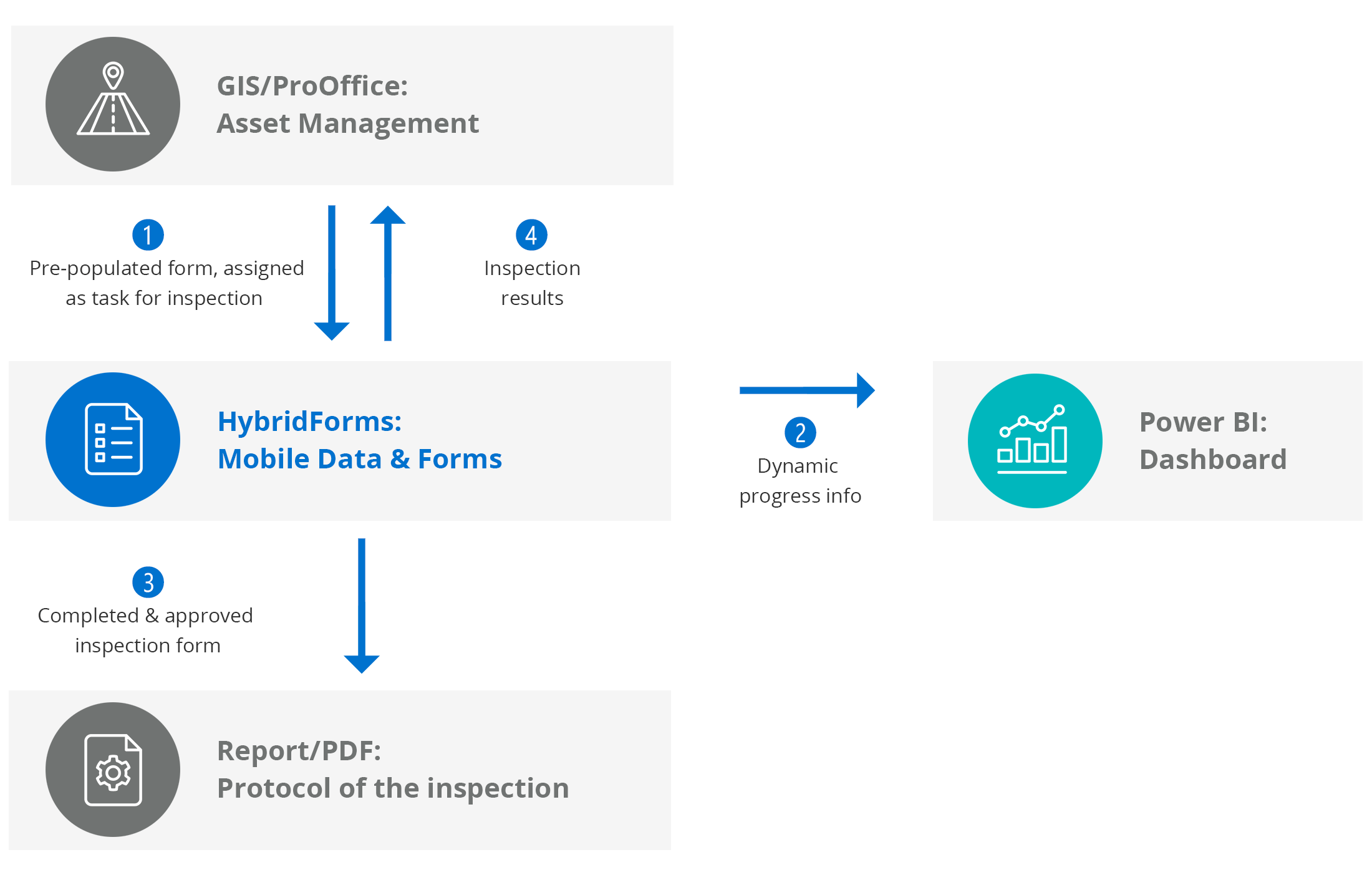
ASFiNAG uses dynamic checklists for the inspection and checking of objects for the entire traffic infrastructure: The checklists and protocols of all inspections and checks of the entire traffic infrastructure are recorded digitally on tablets directly on site – including extensive photo documentation with advanced GIS function as well as defect recording with history.
HybridForms – Digital forms for critical infrastructure
The entire process of technical inspections of assets – from creating a new assignment, pre-filling data fields via form automation and interfaces, mobile data capture by field teams using GIS and Connected Maps, to data export to existing systems – is completely digital.
Dynamic offline inspection checklists with intelligent enterprise features and integrated process functions support experts in their work, such as seamless switching between offline and online mode, automatic data synchronization, geotagging of photos and dynamic defect tracking, as well as historized data exchange with the ProOffice asset management system from SynerGIS.
HybridForms supports various authentication systems for correct access to HybridForms according to IT security requirements. For user login, Microsoft Active Directory (AD) is directly integrated at ASFiNAG to ensure optimal security on all iPads and iPhones as mobile clients.
Interfaces to internal systems enable adaptive dynamic forms that automatically show only the actual components of the respective objects.
Dynamic checklists for the inspection of infrastructure objects (such as bridges and tunnels) on freeways and expressways by ASFiNAG with HybridForms
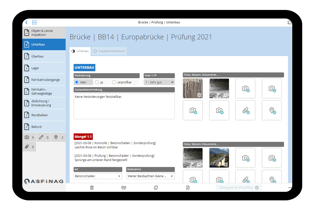
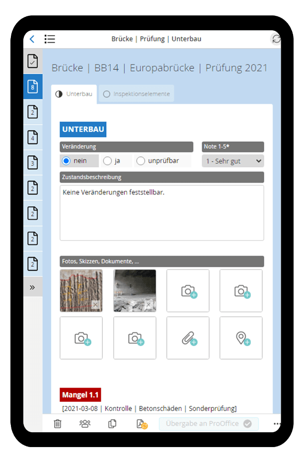

»As one of the central components of ASFiNAG’s infrastructure management tool IMT, HybridForms makes a significant contribution to handling core tasks of structural maintenance management such as performing periodic checks and inspections, recording and tracking defects, and initiating resulting actions as an end-to-end digital workflow.
A particular plus point is the possibility of straightforward connection to third-party systems – whether for analysis purposes, for visualization of the collected data on dashboards or for progress documentation.
HybridForms is outstanding in its ability to automatically generate form structures adaptively and dynamically on a large scale for each individual object, and to map the variety of different engineering structures in ASFiNAG’s asset management, from bridges to tunnels, from noise barriers to overhead signposts, in the electronic forms in a customized manner.«

»The teams of the Structural Maintenance Management handle around 6,500 inspections of engineering structures such as bridges, tunnels or protective structures every year. The complete and proper documentation of these inspections and checks is very important.
The ability to carry out and complete these inspections on site using a mobile device saves a lot of time – time that can be invested in one of the core tasks of ASFINAG’s asset management – the engineering assessment of the objects and the planning of maintenance measures. This makes a valuable contribution to ensuring the availability and safety of the road network.«

»HybridForms, one of the essential pillars of our ASFiNAG Infrastructure Management Tools, enables us to execute and process tasks assigned to ASFiNAG Asset Management involving structural inspections. In the process, road availability can now be determined very flexibly on location using tablets – and in the office as well, using desktop equipment. The clear and easy-to-use mobile app interface provides our employees with a state-of-the-art tool, replacing the analog formalism they had to deal with previously.
Standards and options specified and controlled by the app enable a permanent assurance of consistent data quality in the course of property inspections and checks. The further linking of the HybridForms application with our IMT system database and a central cockpit as a superordinate graphical user interface will facilitate and enhance many processes in production operation and make them more efficient overall.
Equally worth emphasizing is the excellent, direct and customer-oriented cooperation with the colleagues at icomedias.«

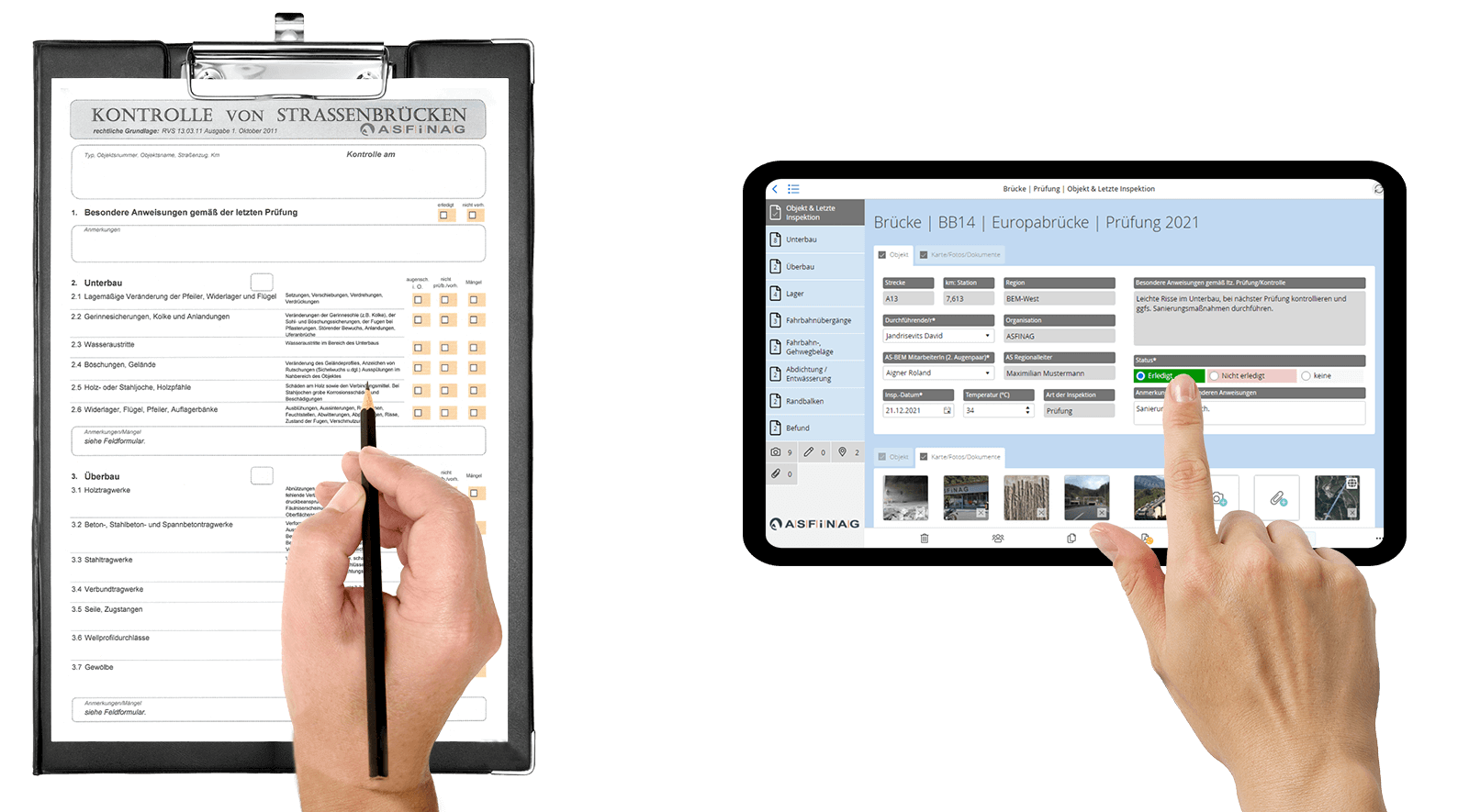
Mobile collaboration in the field with HybridForms: Consistent data sets, accelerated workflows & custom-fit forms through dynamic display of object data
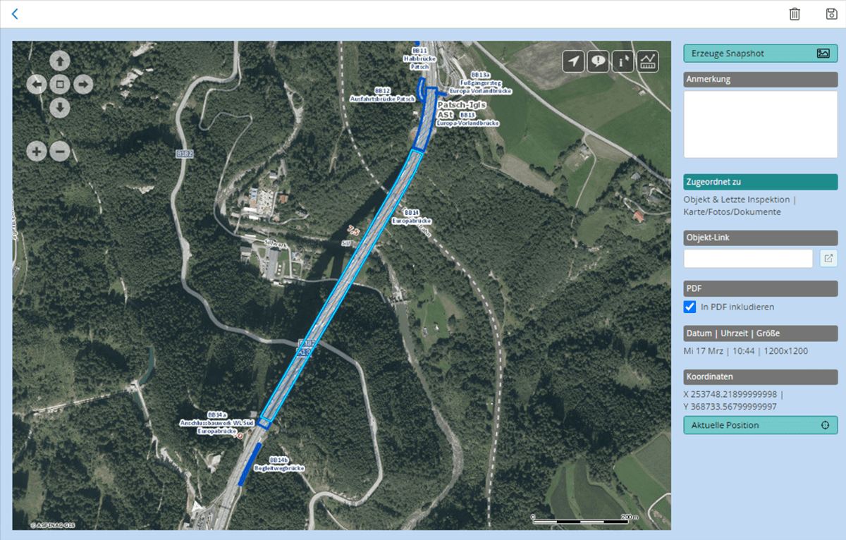
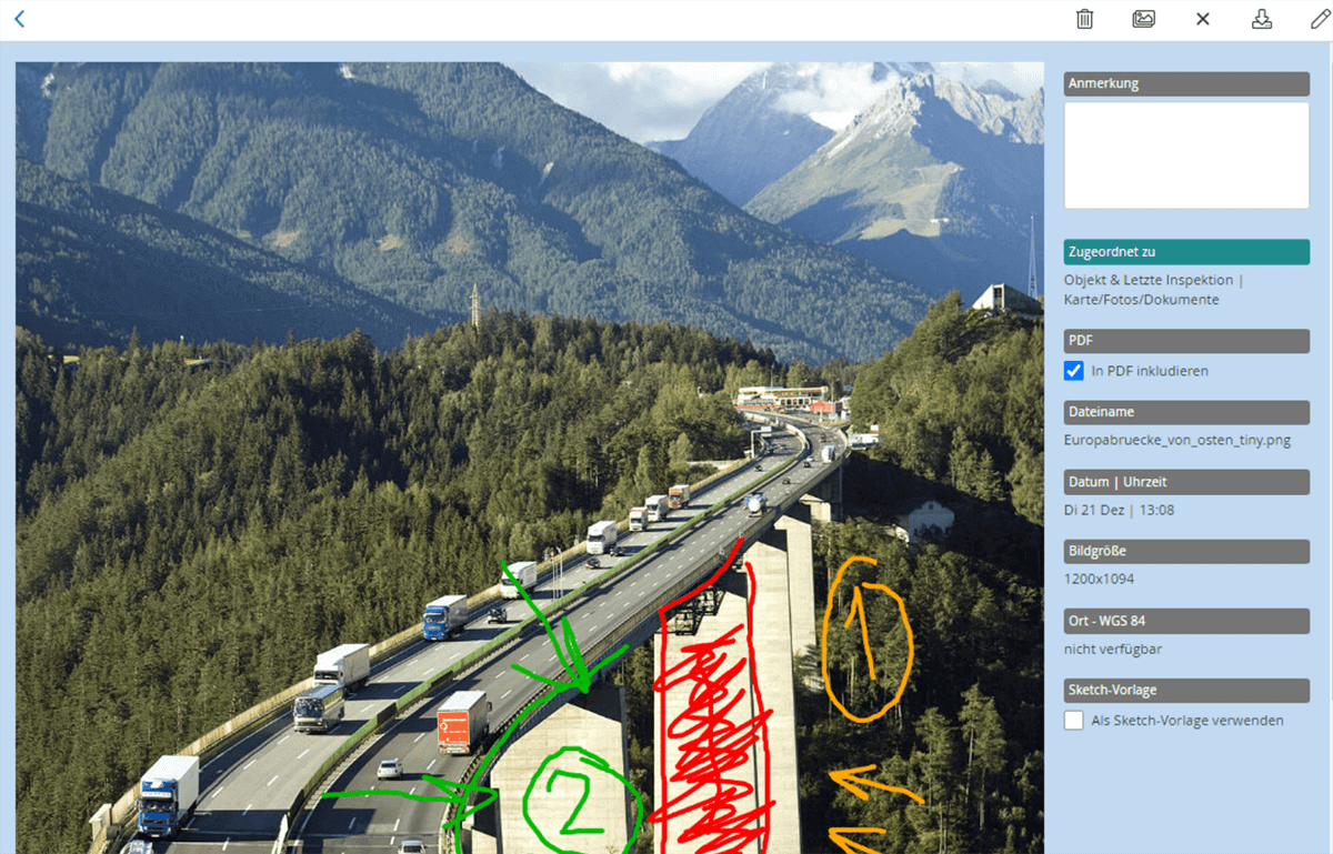
Dynamic GIS integration to ProOffice/ESRI Connected Maps
With the extended map function of HybridForms, maps from different map providers or even multiple instances from the same provider can be dynamically integrated into the forms – such as ProOffice/ESRI at ASFiNAG.
Use of Connected Maps: For professional users who have their own GIS applications in use, such as authorities and organizations for emergency services & rescue services and companies operating in the field of CRITIS.
CRITIS: HybridForms with secure enterprise features for mobile data capture & digital documentation in technical field service for critical infrastructure
Digital transformation and gateways to primary systems